 Pre-flight
Instruction
Pre-flight
Instruction Dutch: 3D_vlucht_boven_Delft.html
German: 3D_flug_ueber_Delft.html
French: 3d_vol_Delft_FR.html
To the right an animated flight in a small GIF movie. A bigger version is available.
An article in http://kalden.home.xs4all.nl/auth/delftintegraal-vermeer-delft.htm
All images here are copyright by Kees Kaldenbach.
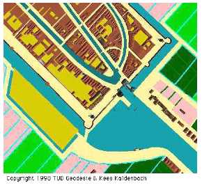
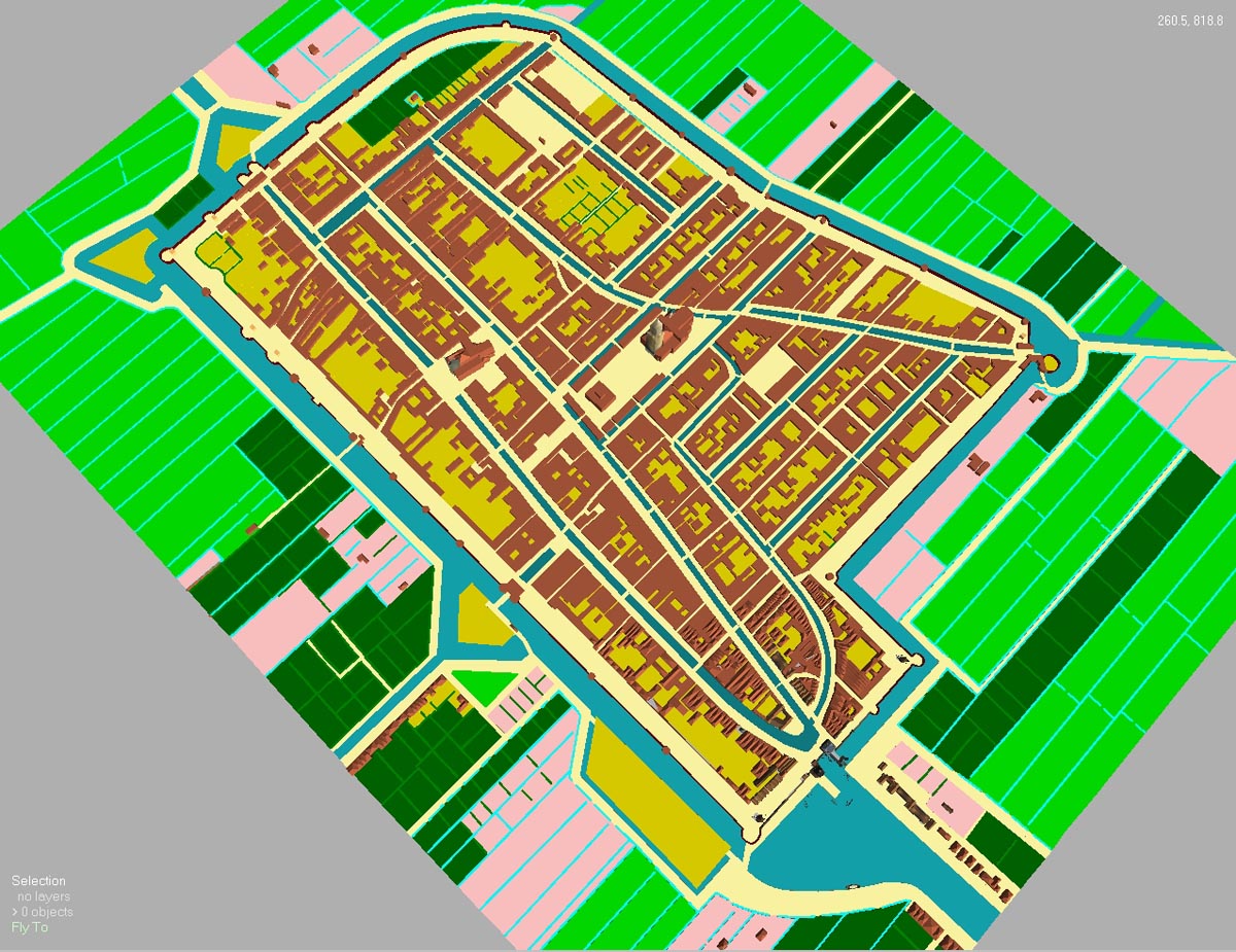
A view straight down.
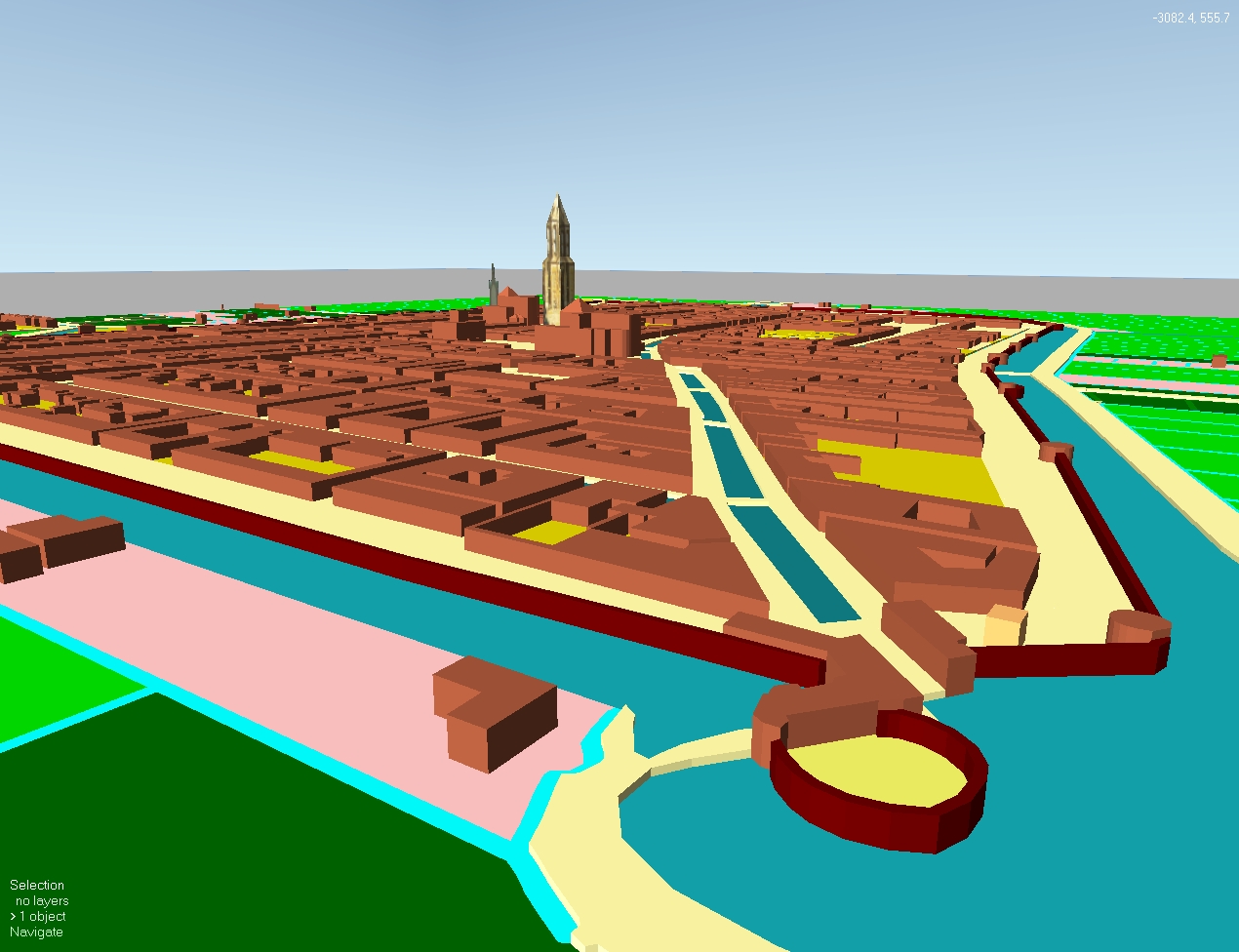
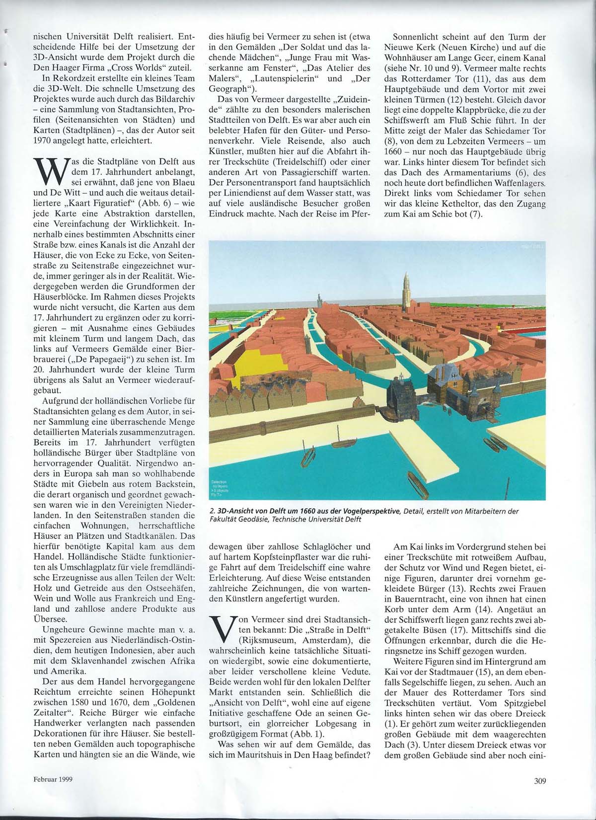
With the help of advanced computer programmes a 3D (= three-dimensional, spatial) representation has been crafted of the Dutch town of Delft as it was in 1660. In order to accomplish this task which was executed in 1998, four consecutive steps have been taken.
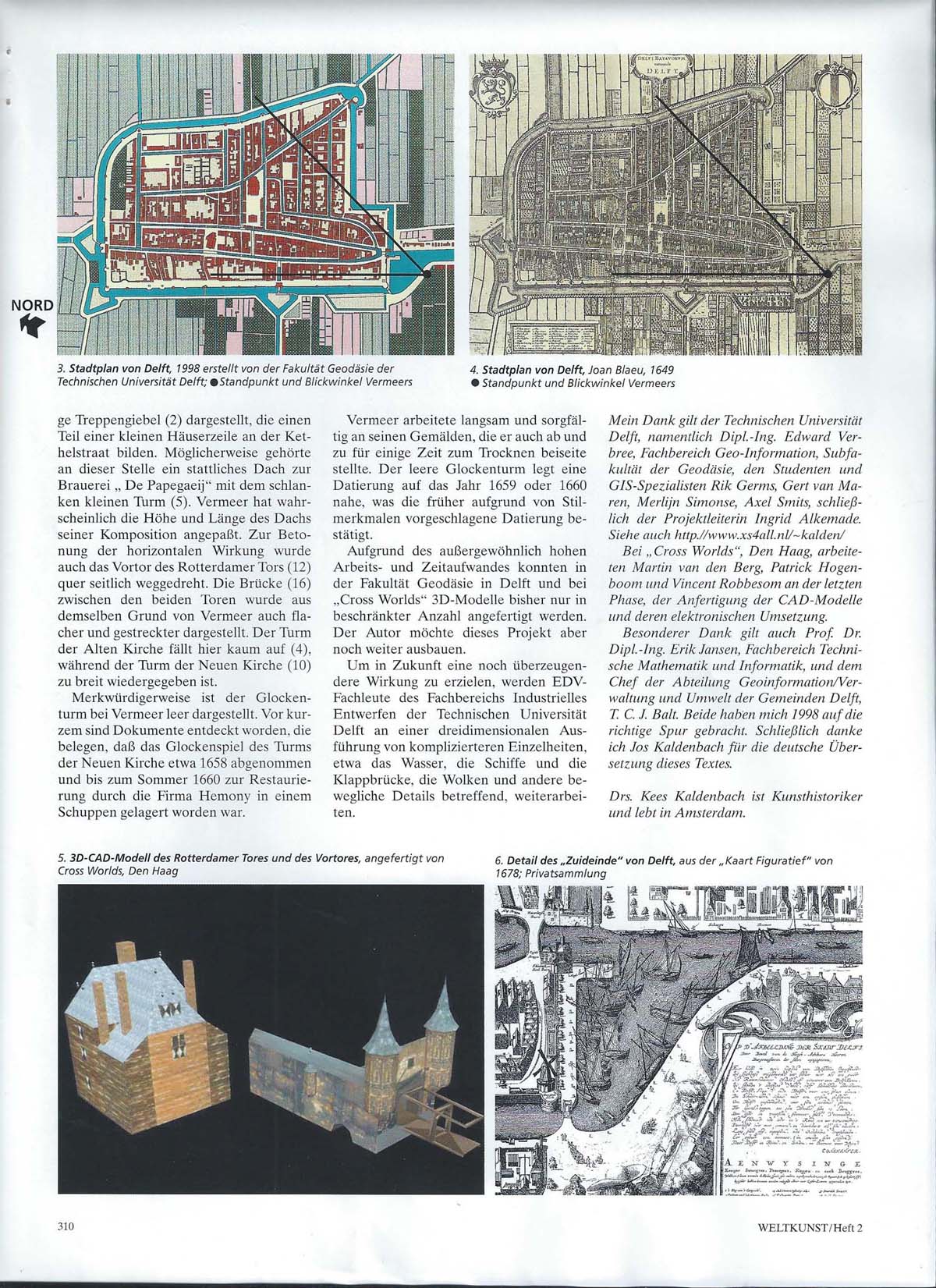
As the very first step a historical plan of Delft has been put on a flat bed scanner and the resulting flat image has been entered as a 'photo' in a computer file. For our purpouses we selected a historical plan of Delft (i.e. the one we put on the scanner) dating from the end of the 17th C, which was made by Frederik de Witt - who in his turn based himself on other maps by Joan Blaeu (1649) and Johannes Janssonius (1657).
 The
flight downwards has started.
The
flight downwards has started.
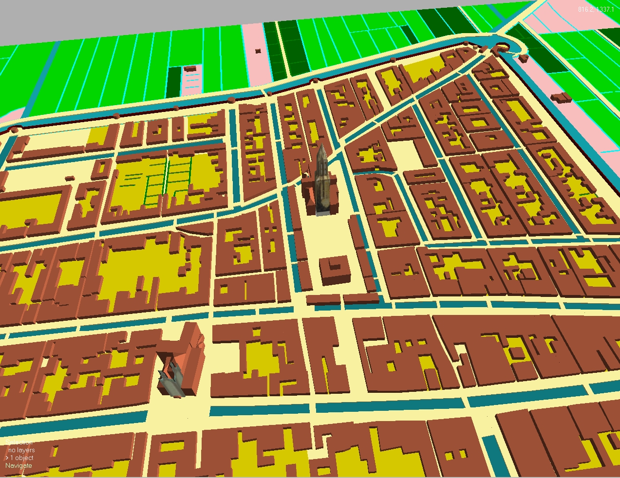
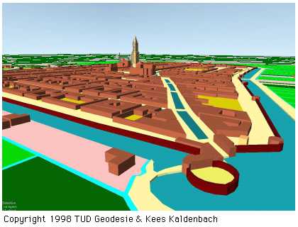
Step two. Subsequently this image - which was shown as a flat picture on a large computer screen - has been traced very carefully - line by line, house by house, by mouse click and cursor position, transferring the system of points and lines into the software of a Geographical Information Systeem (GIS). Each set of digital point outlines the border of a given site. Then connecting lines are drawn between a number of these dots, resulting in a coherent set of points and lines, forming a polygon. Each and every polygon symbolises an object (house, street, canal, bridge, field, trees, etc.). To take an example: the ground plan of a simple, rectangular house is constructed by fixing four points and four lines in a simple rectangle, attaching the code for 'house' (in the turbo language used by computer-operators: 'the polygon gets an object-identity'). It is clear that the GIS is an advanced type of geographical 2D map, which has been constructed of points, lines, vectors which form sets of polygons, each of which has a coded identity. There are even more than one layers of codes possible in GIS. If one wishes to define a bridge, then it will get the codes for 'street' as well as the code for 'water', for the land road and water way each continue unobstructed. The GIS for this Delft map consists of about 1700 separate coded objects.
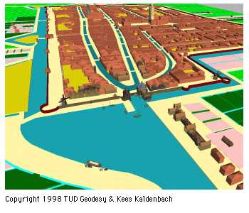
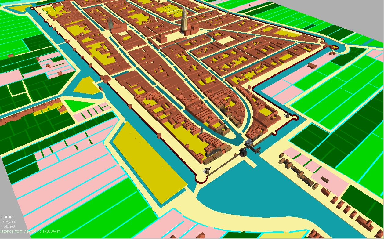
After finishing this labour intensive work it becomes time for step three. The objects coded 'house' are given a jolt by flicking a switch and all houses are given a height. This height has been defined for each object. The result is a map with blocks of houses resembling matchboxes, each object having a specific height. Seen from the side, this effect is already quite life-like, although the block shape remains noticeable. GIS specialists call this state of affairs 2,5D. The map of the town, which in fact is still flat (2D), has now taken on the shape of a model.
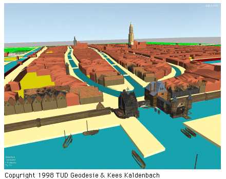
The fourth step marks the birth of true 3D. With the aid of a 3D-Computer Aided Design (3D-CAD) programme one can craft 3D representations of a number of GIS-objects. These take the place of former GIS objects. CAD creates a full spatial effect for any object, however complicated it may be.
In Delft this flight has been crafted with 'Karma', a powerful software programme, which was developed by the Subfaculty of Geodesy in collaboration with the Faculty of Technical Mathematics and Informatics of the Technical University (TU) of Delft. Major help has been given during the last phases of the building programme by enthusiastic people of the company Cross Worlds, The Hague.
Finally the 3D shape which has been created with the help of 'Karma' has been covered on each and every outer surface with small bits of flat 'photo' finish, be it walls, roof tiles or other materials. Whenever possible we have selected historical 'footage' in order to get a close resemblance of the desired structure, texture and color.
The entire system is now finished. Further computer manipulations allow us to choose any angle or viewpoint we wish, whether it be a view from above or an oblique view. For the first time in history one can recreate on a computer screen or on a large scale wall image (with a video beamer) a birds'eye flight above 'Delft, 1660'.
Viewing required special glasses. These 3D glasses used in Delft were of an electronic kind, combining polarizing effects with electric currents, alternately shutting off the left hand side and then the right hand side - and repeating this trick many times a second. The video beamer also gave separate light pulses of light in the same rhythm, each time projecting an image as seen about 10 to 20 cm. apart, first as seen from the imaginary right hand eye, then from the left hand eye, etcetera. With some concentration and practice one's eye indeed jumped to correct 3D depth vision. However a few onlookers could not jump to this vision at all. Unaided by these special glasses the image was flickering and somewhat blurred because of the quick changes in perspective.
All of this labour intensive digital work was carried out in October and November 1998 by a team of the Subfaculty of Geodesy of the University of Technology Delft - with major assistence of Cross Worlds. The staff of Geodesy wished to mark its celebration of '50 years of Geodesy' by creating something truly extraordinary, advertising the powers of modern GIS technology. Thus by the beginning of 1998 a number of Geodesy staff members were on the lookout for a project which would do justice to their celebration.
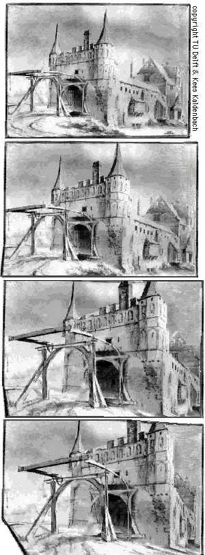
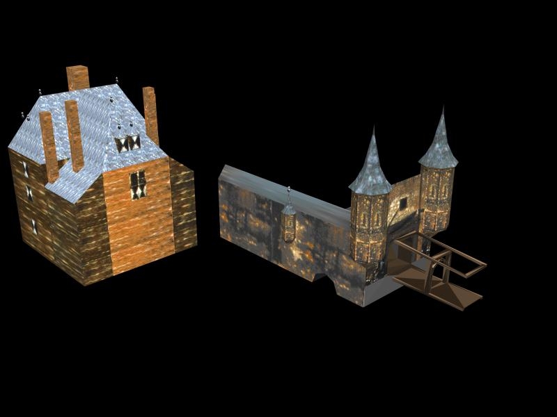
Click here for a large image of the Rotterdam Gate in 3D being built.
During the summer of 1998 I wrote a letter to the Geodesy department of the 'Technische Universiteit Delft', with a wild idea to create this flight, being in blissful ignorance of the vast amount of work required.
The Geodesy department were just in need of a spectacular project, showing the prowess of its department in harnessing the latest GIS visualisation technology.
With the speed of lightning this project unfolded itself. The 'View of Delft' was selected as a subject. A small team of computer specialists then crafted a 3D world. This fast production as also due to an image bank which I had collected from 1970 onwards. This archive consists of a documentary collection of paintings, drawings and prints of city views of the South side of Delft. I have subsequently donated this archive to the library of the Royal Collection of Paintings, Mauritshuis, The Hague.
The virtual camera position is about 4 meters high here. Vermeer was just around the corner.
When it comes to 17th C plans of Delft one soon notices that all maps - whether it be maps by Blaeu or De Witt - as well as the much larger and finer detailed Figurative Map ('Kaart Figuratief') - are all in fact abstractions. Or in other words: reductions from reality. Within a given segment of a regular street or a street, which runs along a canal - the number of houses which has been engraved from corner to corner, from side street to side street, is nearly always smaller than the actual situation. The general shape of the blocks of houses however has been engraved reasonably accurately.
Within the framework of this project no attempt has been made to alter or correct the map - with the exception of one building. This is the building with the extremely long roof on Vermeer's painting: the brewery 'The Parrot' which can be seen on the 'Figurative map'. This building contains the slender tower, which stands out in Vermeer's painting. In the 20th C. a similar tower has been rebuilt (I think in quite the wrong spot) as a salute to Vermeer! As the map by De Witt does not show a large brewery but a simple small house this item could not be retained. We chose to insert the building shape from the 'Figurative Map' of 1678, which is very large and detailed.
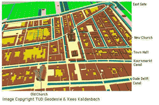
View at the center, looking east
A real-time presentation of the above was on show in the Technical Museum of Delft. By moving a special 3D space mouse every visitor could start a computer programme and fly over Delft interactively. Special glasses allowed to see depth in a stereo vision. This presentation was held from November 12 1998 through January 7, 1999.
In April 2002 I gave a lecture and internet presentation on this subject to a society of TU Delft engineers, called HISTECHNICA.
 NEW
NEWA movie will be online at the site of the Department of Industrial Design, Delft from 27 June 2001 onwards:
This new project is the production of a Quick-time movie showing a walk through the gates Vermeer depicts in the View of Delft. This project is financially supported and executed by the Department of Industrial Design of the faculty OCP (Design Engineering and Production) of the Delft University of Technology. Work is executed by the student Petrik de Heus and his advisor, software supervisor Assistent Professor Aldo Hoeben. Both are backed up by a team of university teachers and professors. This project has actually started in May 2000 by scanning the necessary images in the Delft Archives who give full cooperation. These basic images will be manipulated with a Canoma software package yielding the basic images for the Quick time movie..
SEE A FURTHER DISCUSSION of this project during a CIHA conference.
Questions about these projects? Do send an email.kalden@xs4all.nl
Kees Kaldenbach, art historian.
All images here are copyright by Kees Kaldenbach.
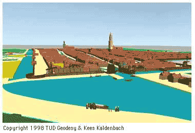
Below: Digital map of Delft, based on a 17th C map, View straight down
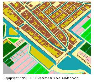
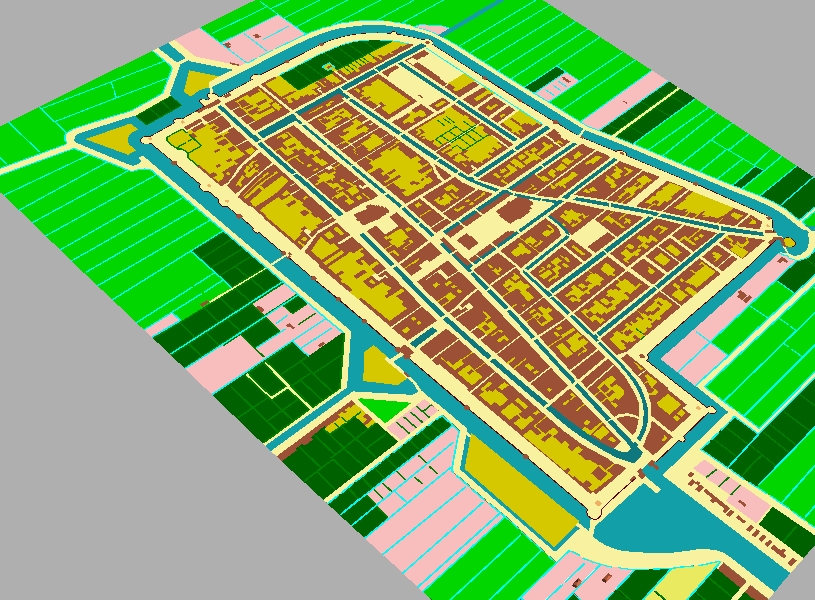
Below: Tilted view.
Below: Lower down.

Below: Camera lowered.
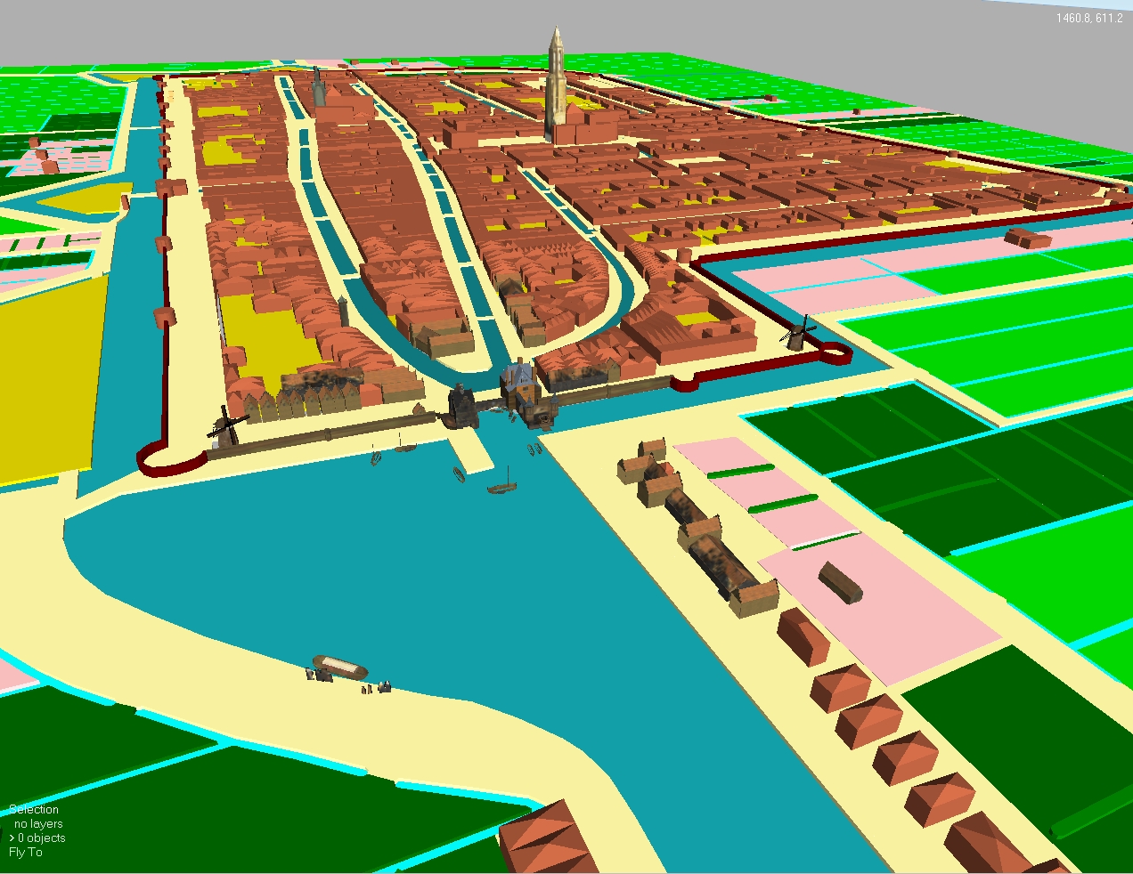
Below: A view hovering at about 60 Meter high. The Old Church tower in the left is 75 M high.
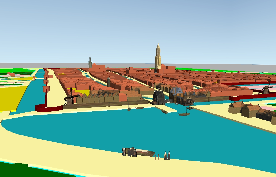
Below: Same height, a viewpoint closer by.
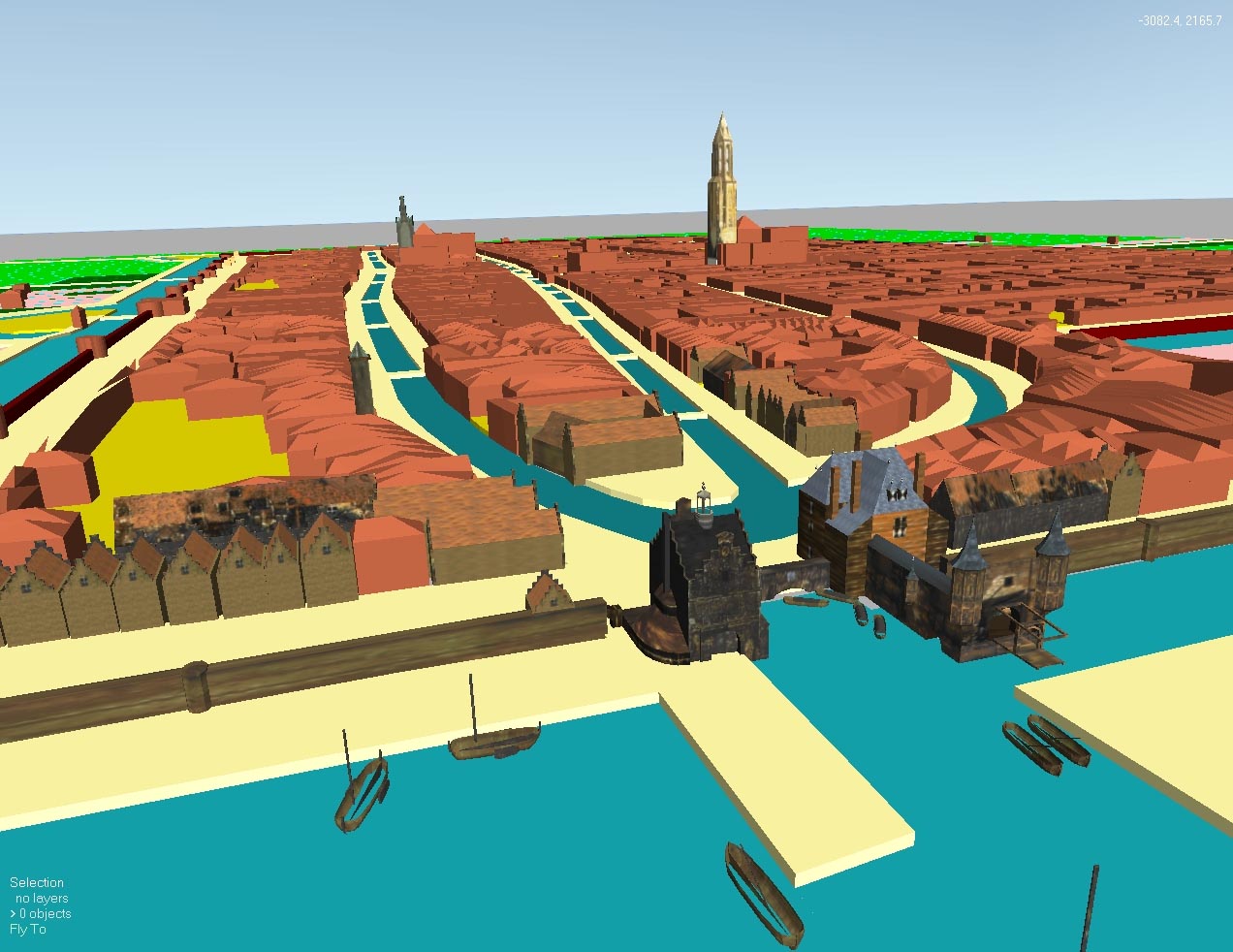
Below: The Rottedam gate, the separate barbican, and its drawbridge was built from geometric shapes and then covered with surface patterns.
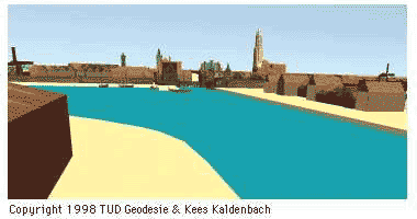
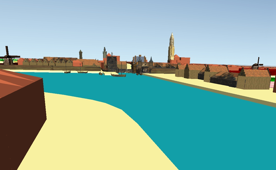
Below: To the side of the canal te Delfshaven, about 15 M high.
Below: To the side of the East Gate (oostpoort) about 70 M high.
Below: A view from just above the Western gate, Waterlandse Poort.
updated 27 January, 2016.
German publication:
Kaldenbach Kees (Autor)
Ein Flug über die "Ansicht von Delft"
Jan Vermeers Meisterwerk von 1660 als virtuelle Welt
Herausgeber: Weltkunst Verlag München : München
Datum: 1999
ISBN-ISSN: 0043-261-X
Project 'Flight over Delft'
Thanks to the 'Technische Universiteit Delft', ir. Edward Verbree, Section Geo Informatics, subfaculty of Geodesy. Thanks also to students and specialists which worked the Geographical Information-System (GIS), at Geodesy: Rik Germs; Gert van Maren; Merlijn Simonse; Axel Smits & last but not least Ingrid Alkemade, project manager.
A special thanks also to CrossWorlds bv, The Hague - where Ingrid Alkemade had her internship - for building 3D models and rescuing the project in the face of a looming deadline, and for applying the finishing touches: Martin van den Berg, Patrick Hogenboom & Vincent Robbesom.
Thanks to prof. dr. ir. Erik Jansen, section Technische Wiskunde en Informatica, & T.C.J. Balt, Geoinformatie / Beheer en Milieu, Gemeente Delft. Both set me on the right track.
I am also indebted to the Department of Industrial Design of the faculty OCP (Design Engineering and Production) of the Delft University of Technology. Student Petrik de Heus worked the Canoma Software. Final software editing, supervision and Internet interface were produced by assistant professor Aldo Hoeben. This team of Industrial Design people brought this ground breaking project slowly but surely forward during the years 1998-2001: Kees Jorens, Pieter-Jan Stappers, Kees Overbeeke. Thanks to Onno van Nierop for making the electronic scans at the Municipal Archive.
http://www2.io.tudelft.nl/id-studiolab/vermeer/
All images under copyright 1998. Please contact Kees Kaldenbach before you copy , store or print any of these images. Text copyright Kees Kaldenbach.
Last update April 22, 2007